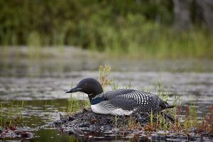
This past year I was fortunate enough to have my youngest brother Larry, invite me to join him for a few days camping in Arrowhead Provincial Park in Huntsviille, Ontario.
Day one. September 27th
On the morning of September 27th we set out for Arrowhead Provincial Park. outside the city of Huntsville. Determined to bypass the congestion of Toronto we travelled through Guelph and Erin on our way to Hwy 9, and on to the the 400 heading north. I wasn’t expecting construction on Hwy 24 in Guelph and we were behind schedule before we knew it. Past Guelph everything seemed to be flowing smoothly. The 400 north to Barrie was busy but moving well. That is it was until a few short miles outside of Barrie traffic came to a near halt. Stop and go at a snails pace we were trapped for what, to me, seemed an eternity. Larry was pulling his trailer and I was following in our SUV.
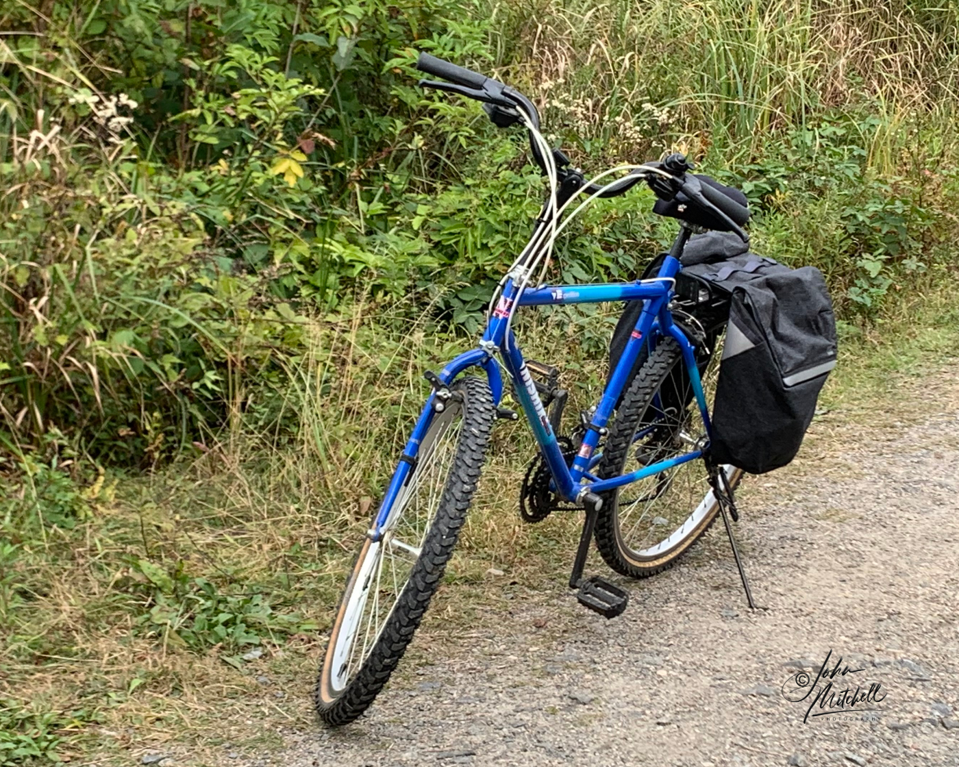
I had decided to leave the kayak at home this trip but had my bike with me. I hadn’t been on the bike for at least 4 or 5 years and decided that riding around the camp might be good exercise.
Next stop was Webers for their famous hamburg for lunch. If you have never been there, Webers is an experience. Their production line and customer service is second to none.
Bellies full it was on to Huntsville and Arrowhead Provincial Park.
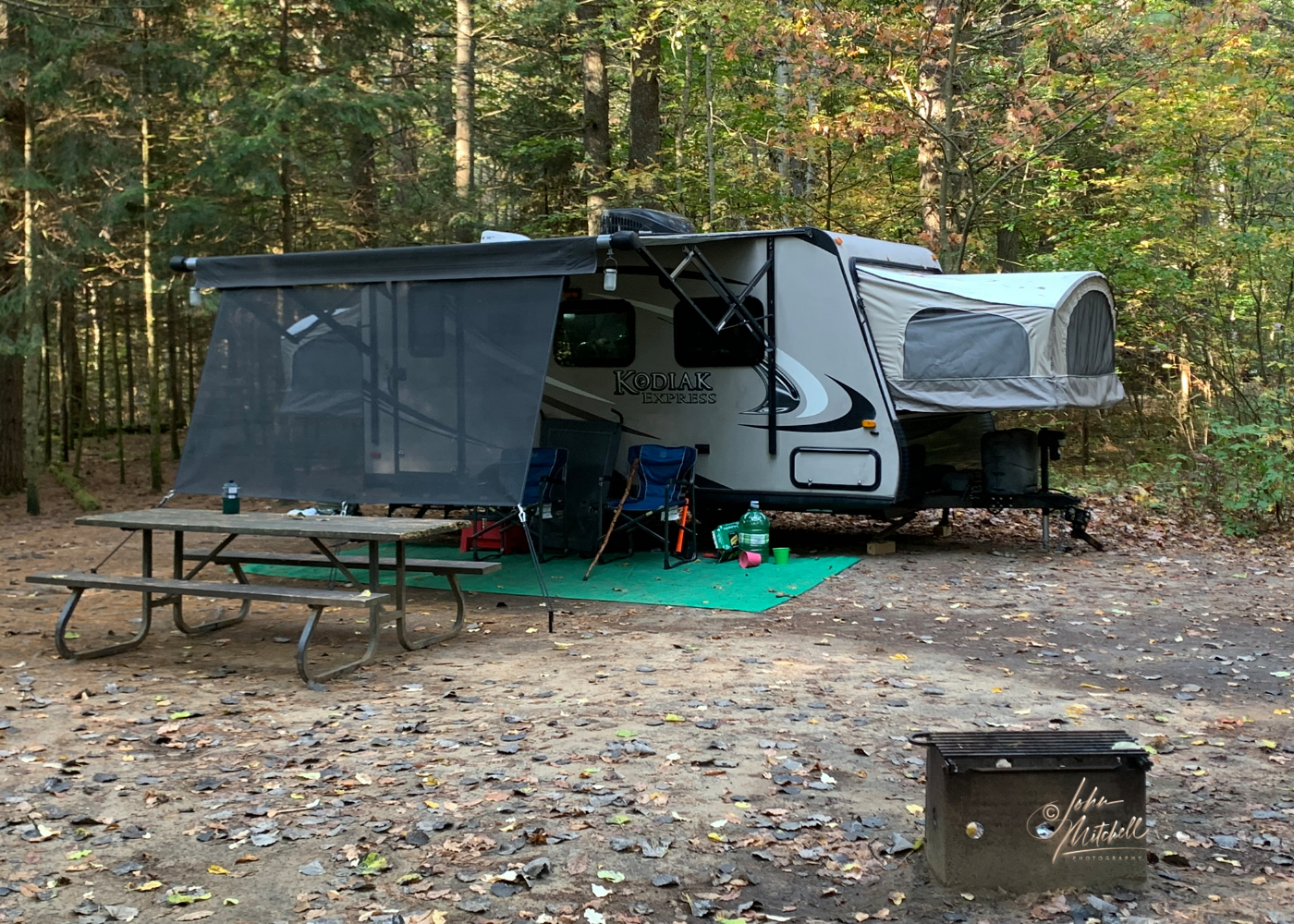
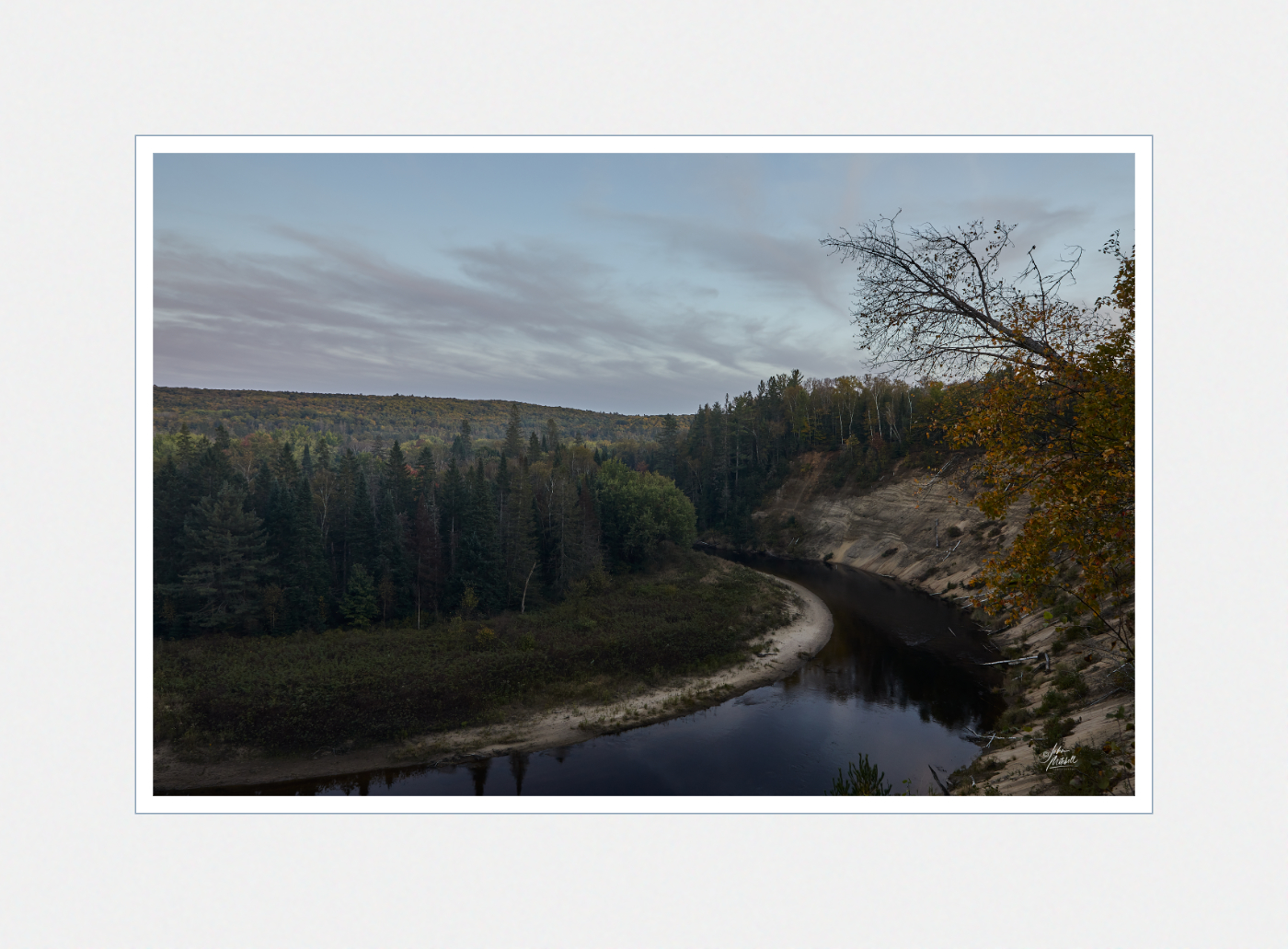
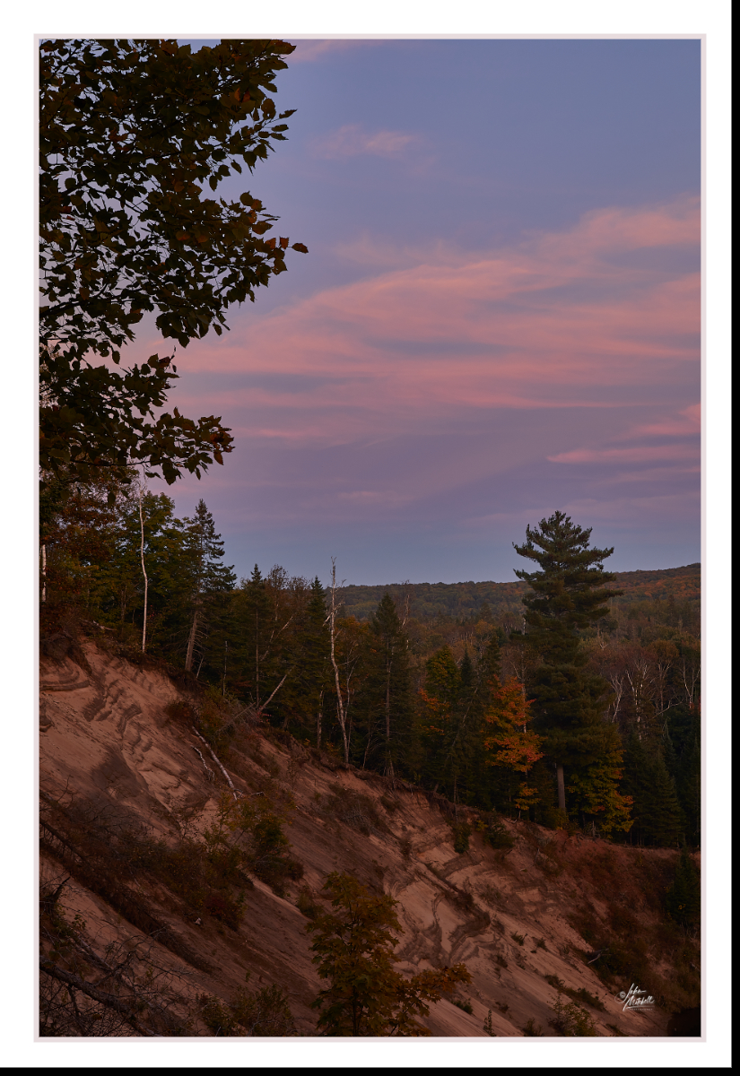
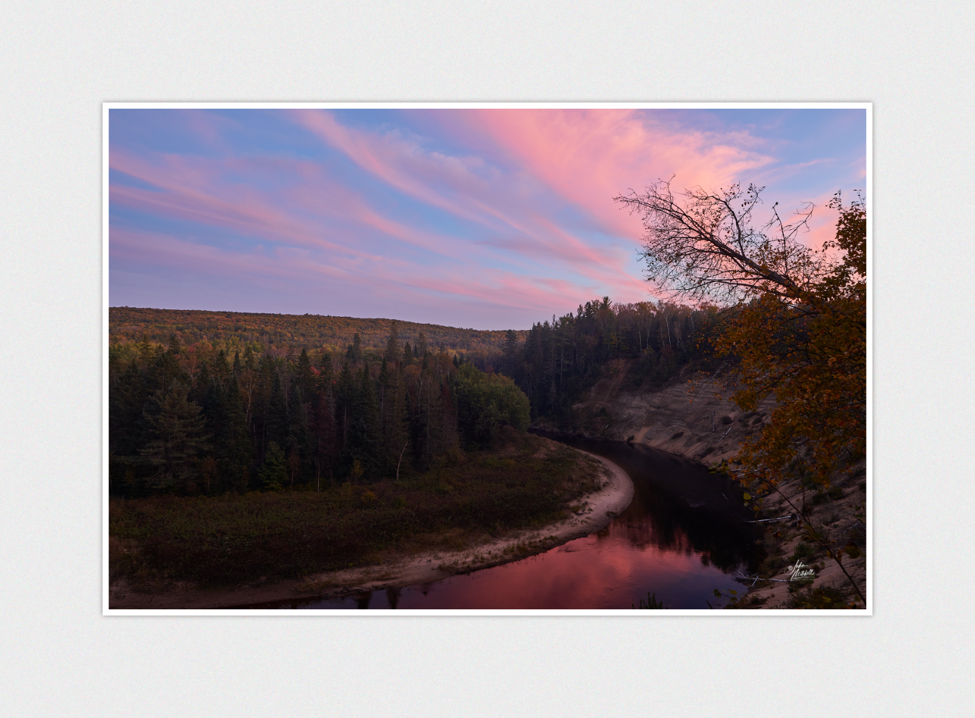
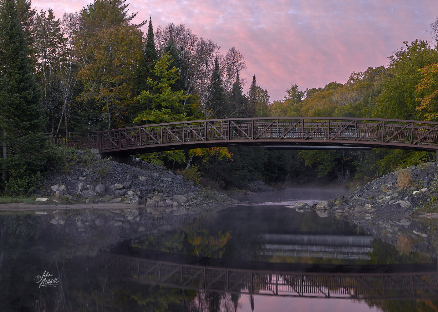
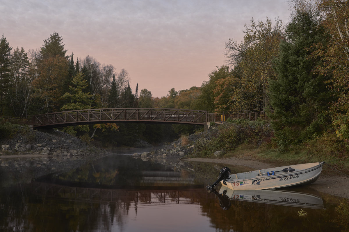
Larry set up the trailer with me helping (my opinion). I was probably more of a hindrance than a help. After a quick bite to eat we decided to go to the the lookout over Big Bend on Big East River and see if we could get any sunset photographs. I set up my equipment and took some “golden hour” images of Big Bend and the sand dunes. The lookout actually faces more south south east (SSE) so we did see the southern sky turn pink, but never did see the sunset. Still, we made the most of our time and got some amazing photographs.
Day two, September 28th
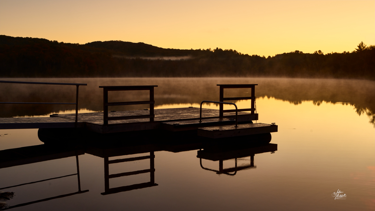
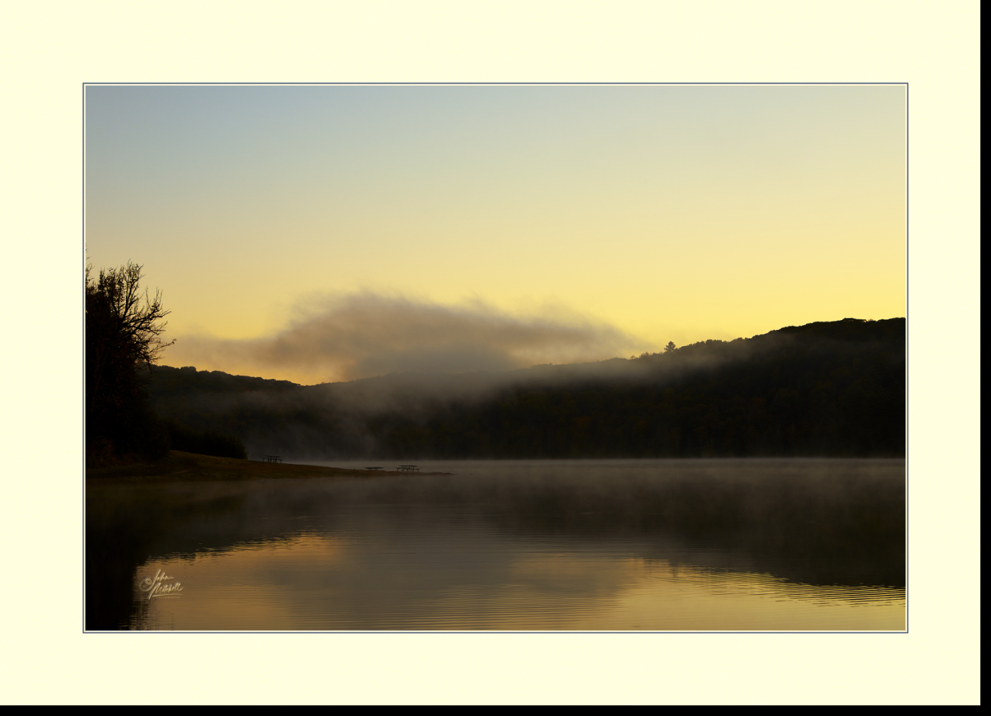
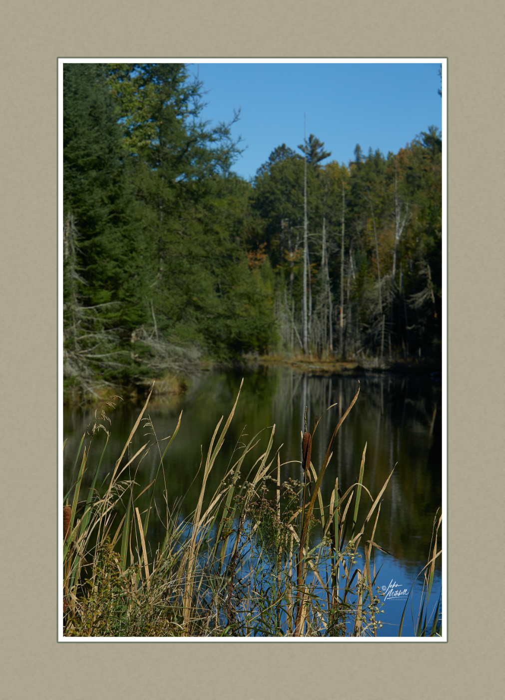
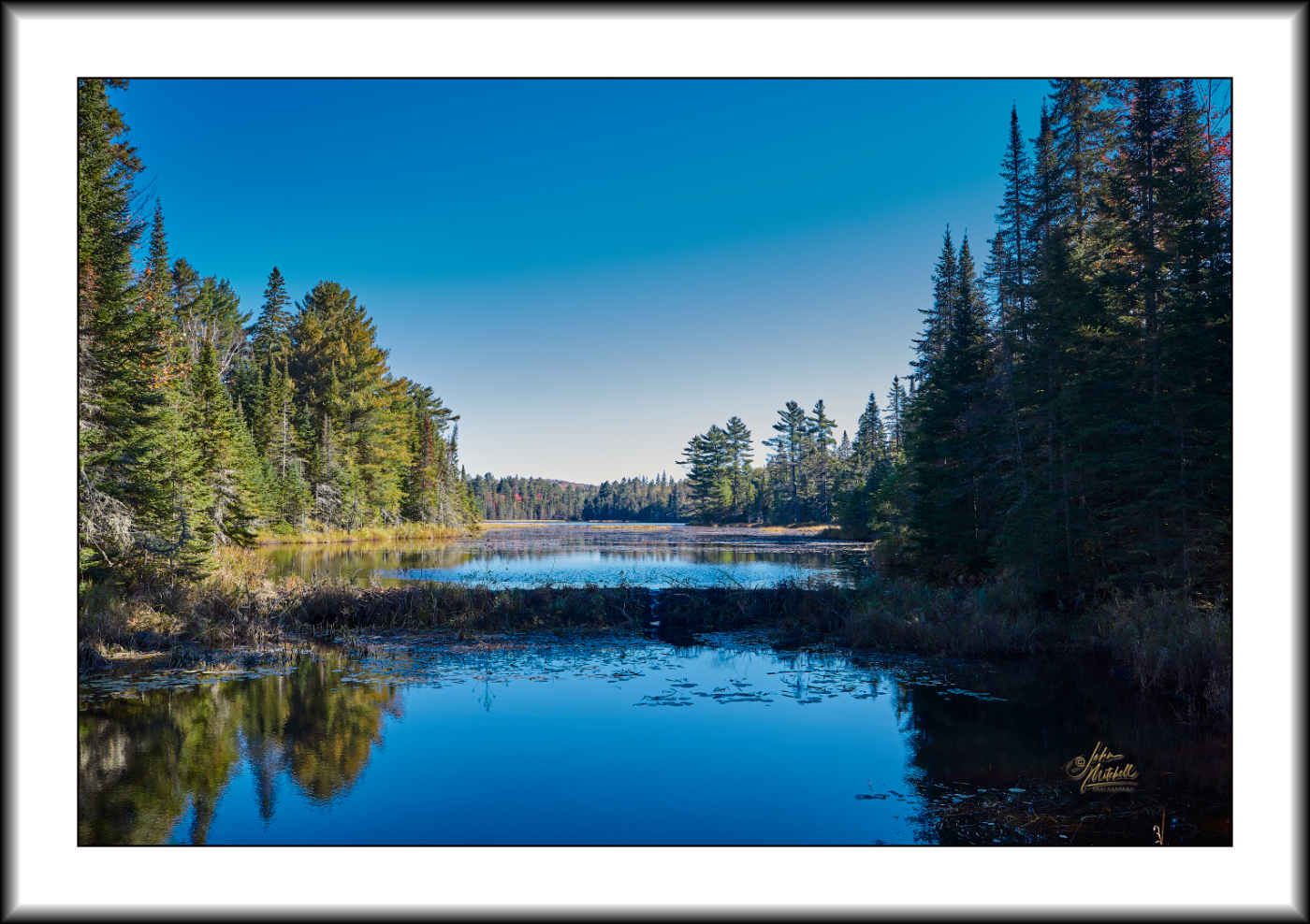
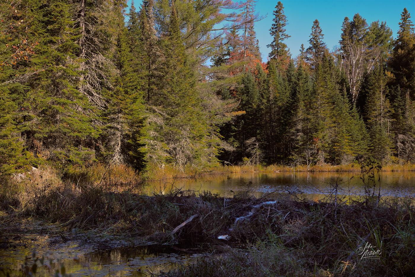
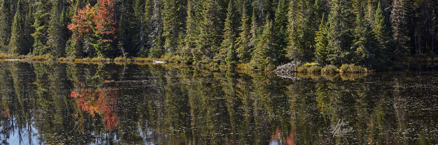
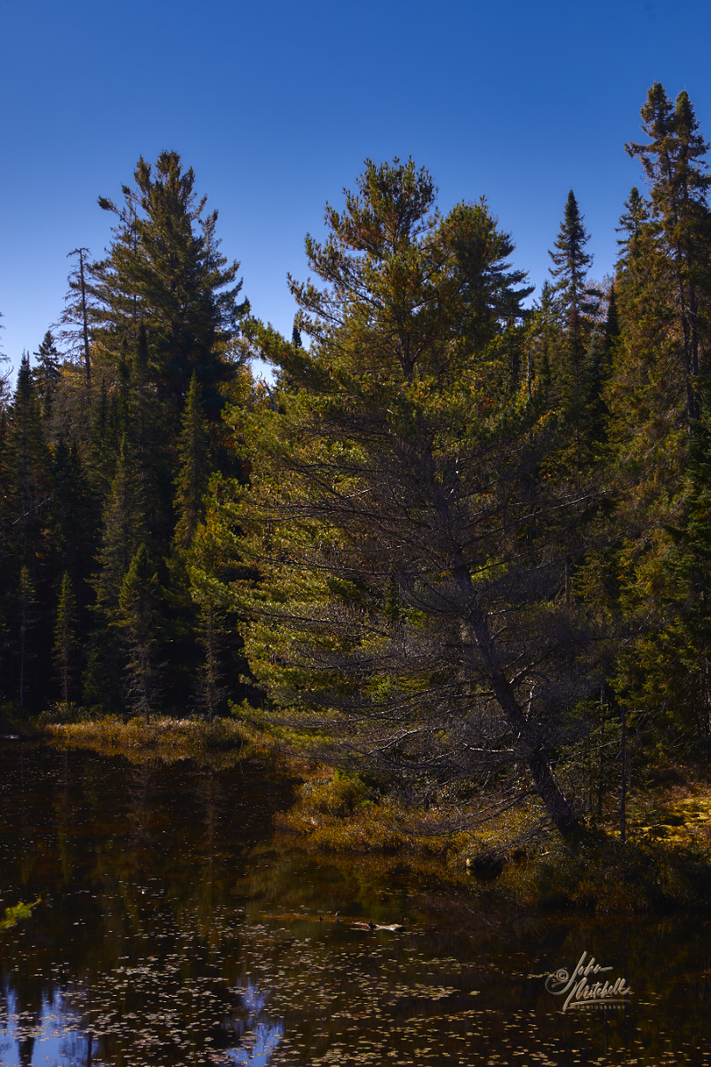
I used to be an early riser almost all the time. That isn’t the case so much anymore, but for some reason when camping old habits kick in. It must be something in the air. I got in the SUV and decided to explore the park a little bit as the sun started to peak its head above the horizon. I ended up parking along the shore of Arrowhead Lake where the Little East River flows out of the lake. There was a mist over the water and everything was so quiet and peaceful. I spent the best part of the next hour looking for different angles to photograph and observing the changes in the light and the mist as the sun warmed the air.
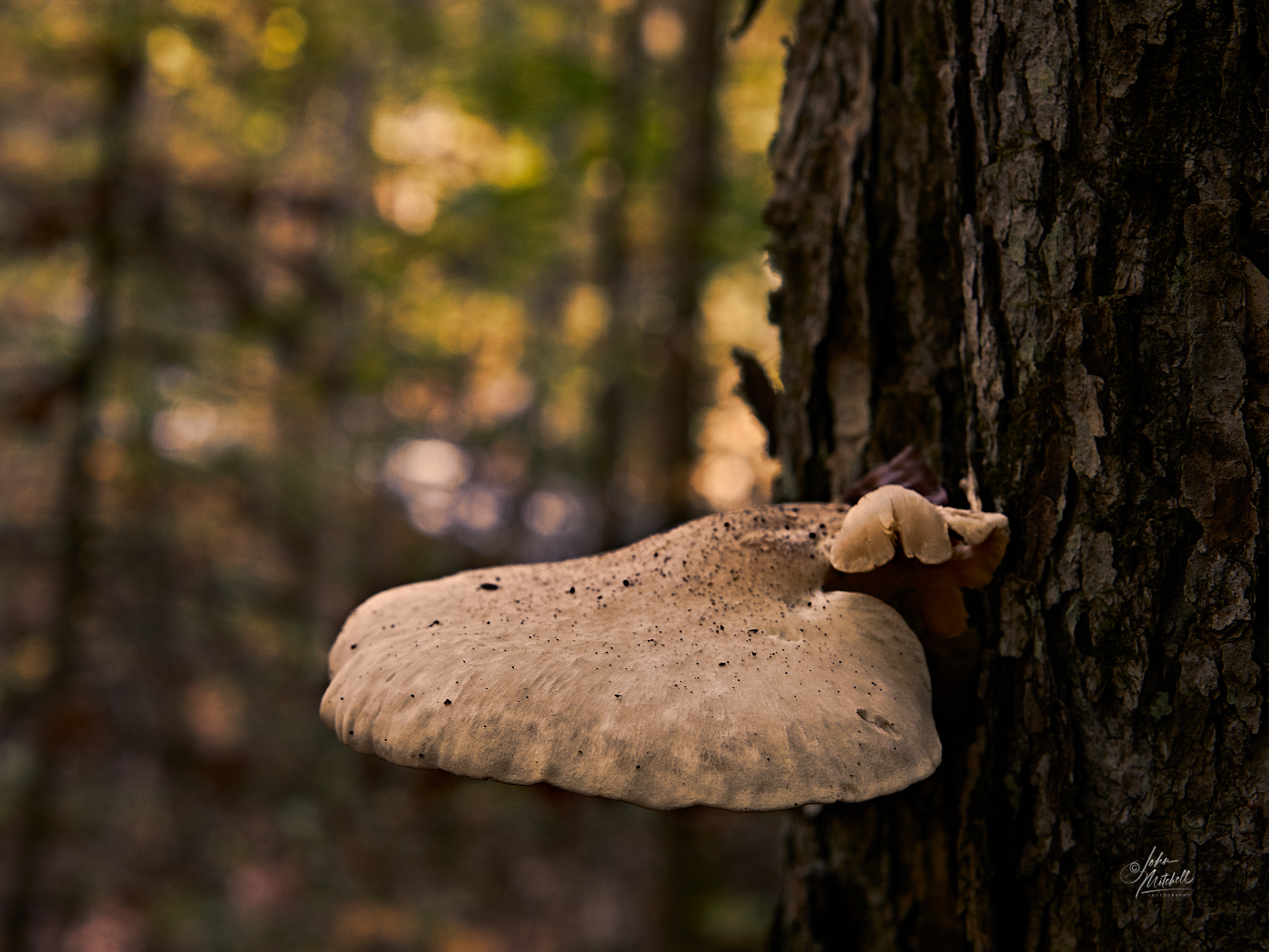
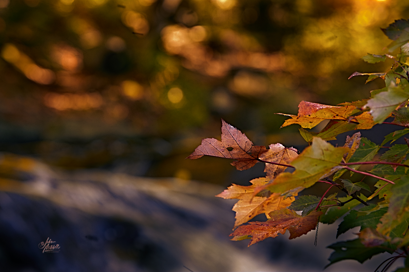
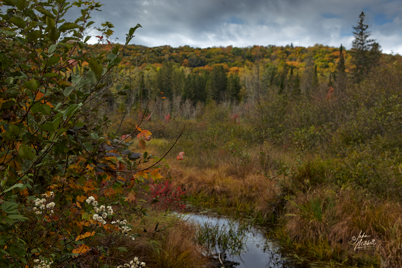
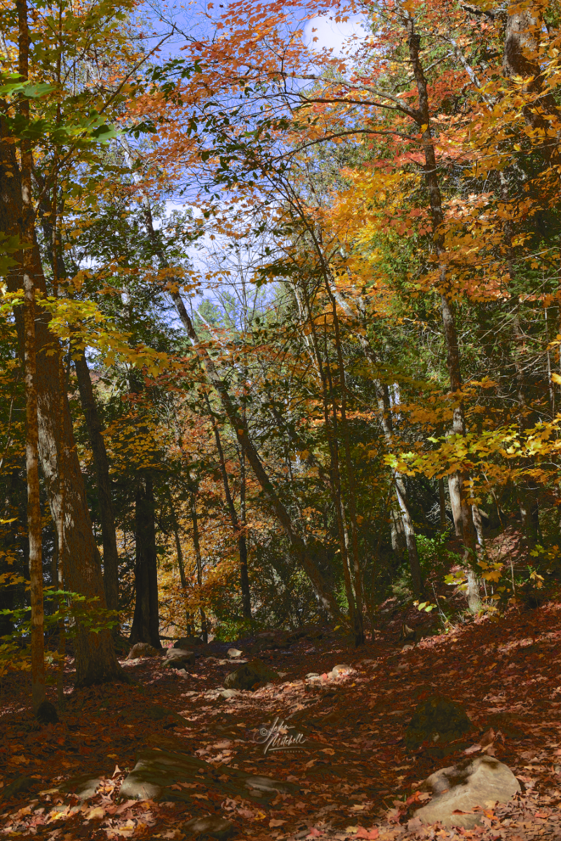
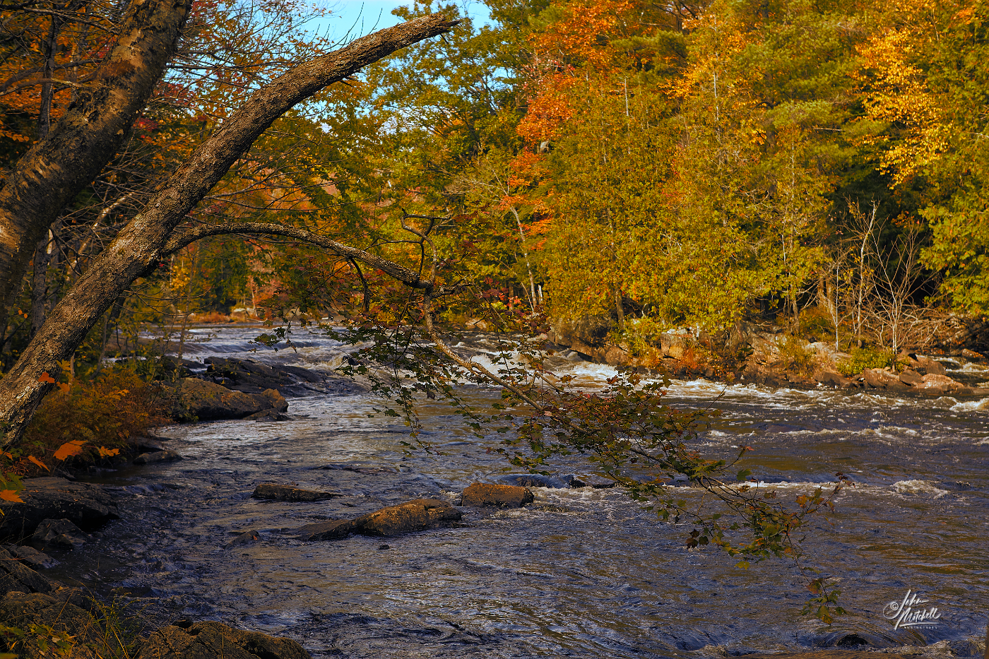
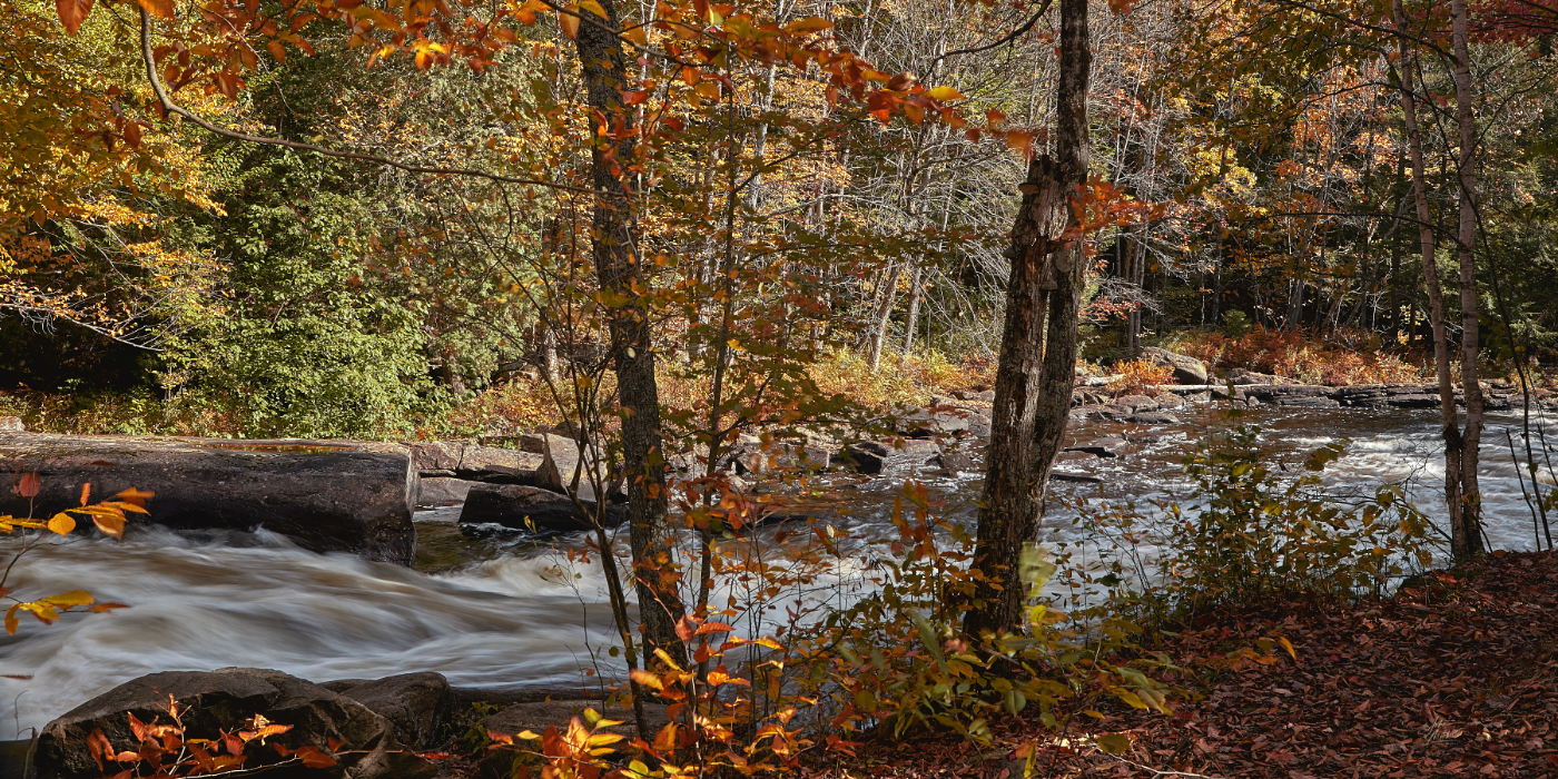
Back at the campsite Larry talked about some waterfalls he wanted to check out. Day two would be a road trip and a time of discovery. We investigated and enjoyed the sites of Marsh’s Falls, Hawk Lake Log Shoot, and Long Slide Falls. The scenery was absolutely georgeous and thoroughly enjoyed the challenge of finding the right angle to capture beauty and express the peaceful tranquility of the area.
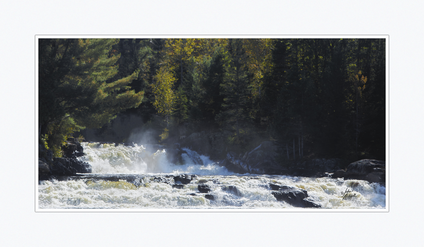
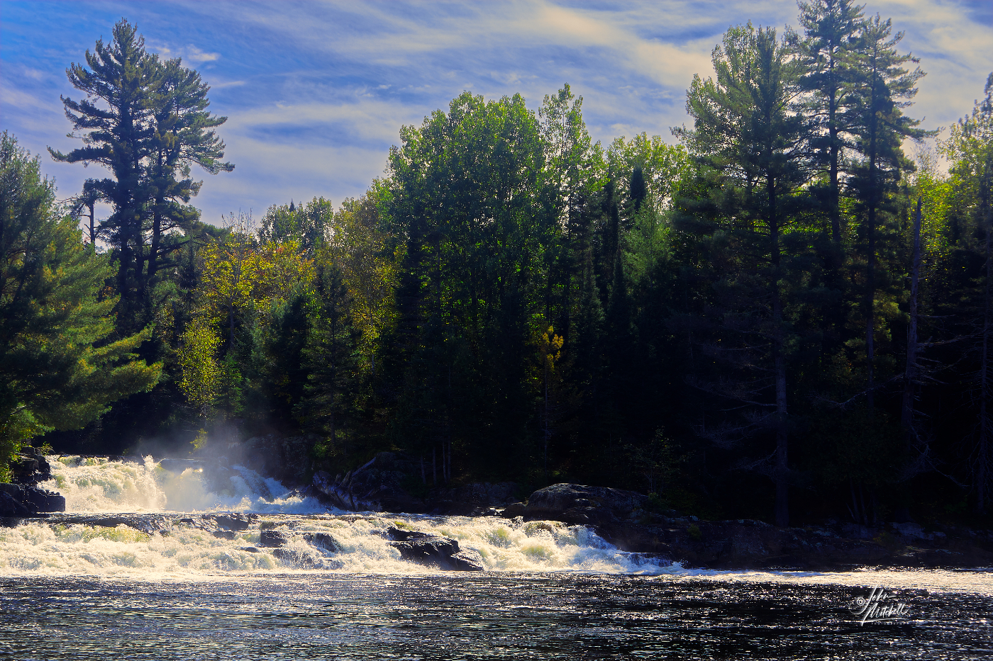
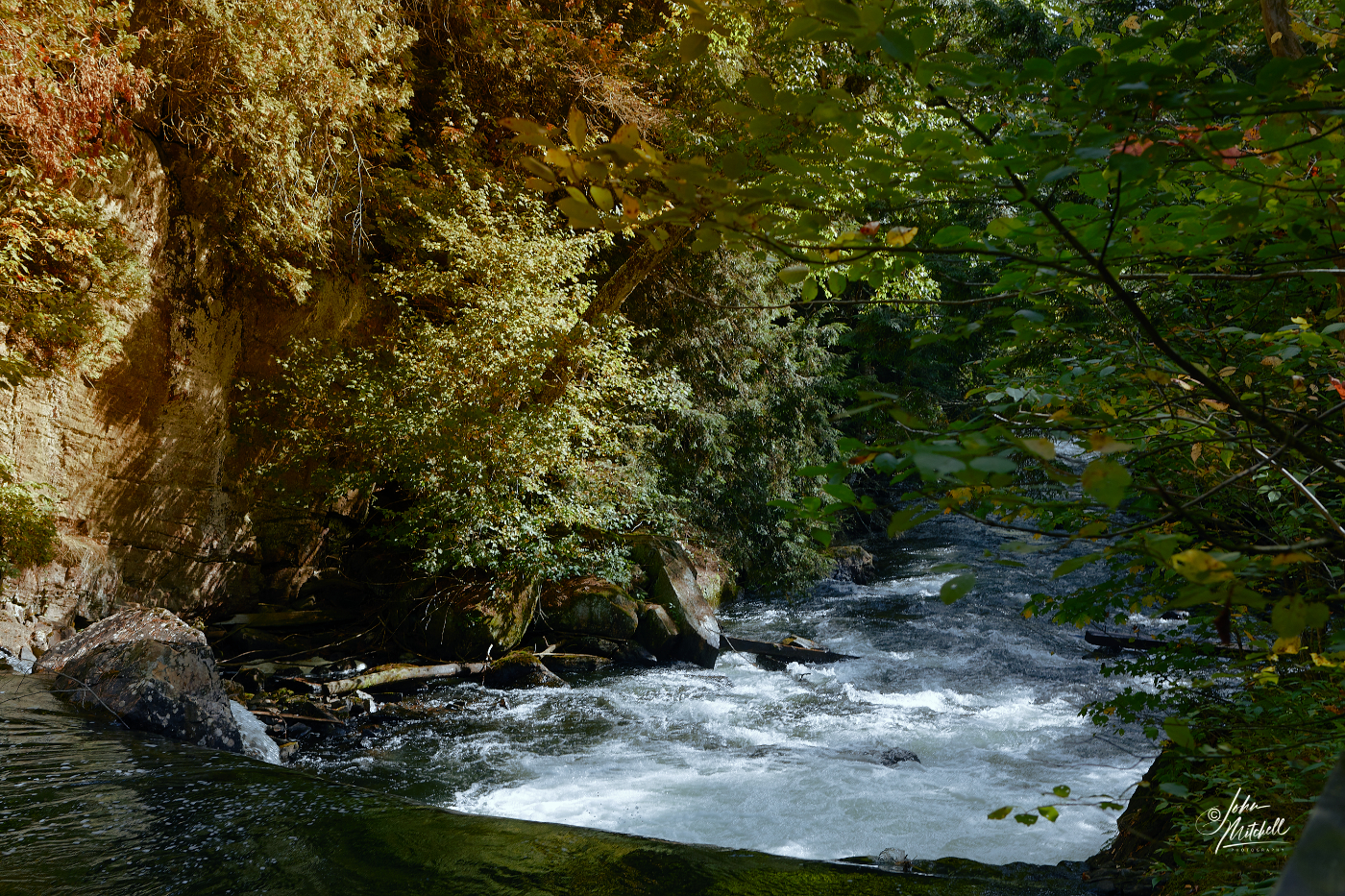
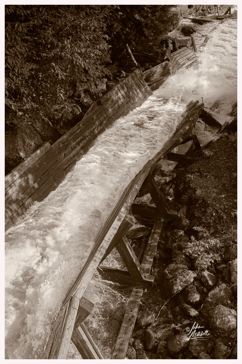
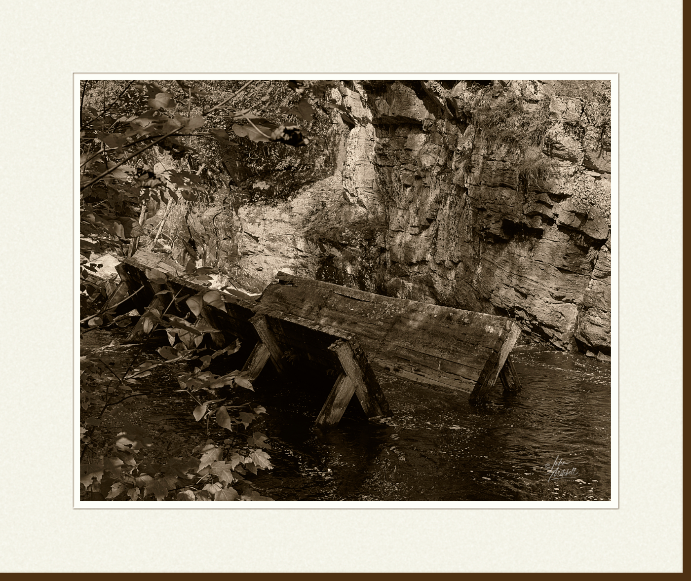
We left Hawks Lake in search of Longslide Falls. I didn’t do a lot of exploring around Longslide Falls. I became intrigued with the rushing water combined with the vegitation and fall colours.
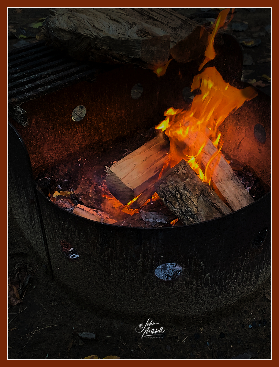
That evening I managed to get a campfire going and spent some time just relaxing and enjoying the warmth of the flames.
Day three, September 29th
There is another waterfall within the boundary of Arrowhead Provincial Park. Stubb’s Falls is on the Little East River and there is a walking trail to the falls. It’s an easy walk on a well groomed trail. The problem is, even easy walks can be too much when you’re an “old fart.” We pressed on and eventually found ourselves looking down at Stubb’s Falls. The sites and sounds made the effort to get there well worth while. Just looking at the size of some of the boulders and realizing that glaciers deposited these rocks there was awe inspiring. Larry and I spent considerable time photographing the area. (Much of that time was spent waiting for people to clear an area you were trying to photograph.)


On the walk back we discovered there was another parking area much closer to the falls. If we were returning for another photo session, we would definately be taking advantage of that.
Day four, September 30th
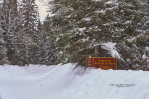
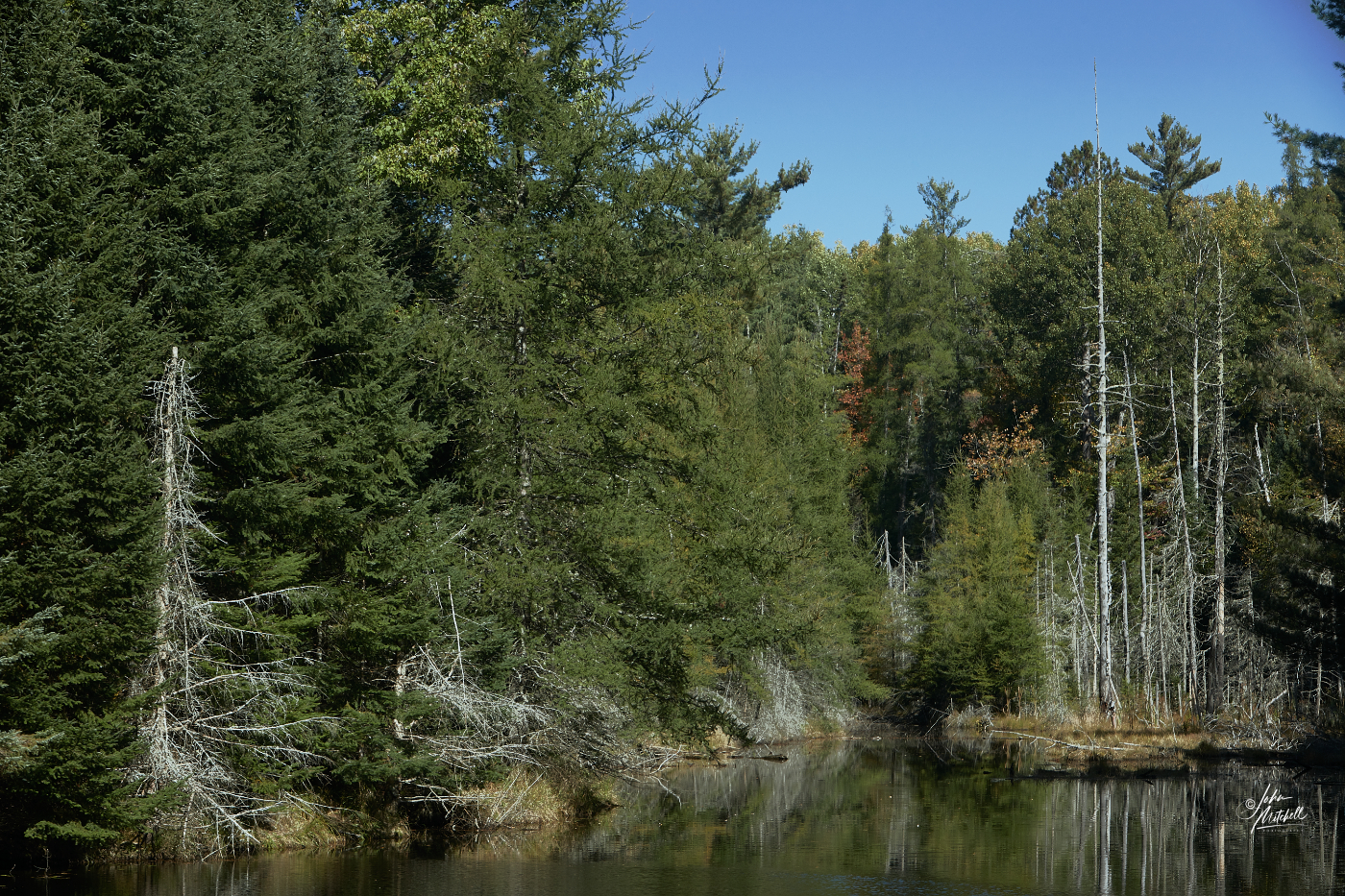
Another day of exploring and photographing. This time we were off to Algonquin Provincial Park. I knew there was a road that lead to one of the many camps located inside the park and I wanted to explore that area. We eventually reached an area where the road branched off. A sign forbid entry to the new branch unless you had a cottage that the road led to. We parked my Forester and set out on foot. The narrow roadway eventually ran along a brim that separated two bodies of water.
Larry introduced me to a new app that was associated with my Garman watch. The app gave detailed description with map of where you were and would track your route | progress. The map showed that the bodies of water were part of Joe Lake. A little further and we came to the area where Joe lake ends and you portage into Canoe Lake. I am certain this roadway was originally the rail bed for the trains that went to Algonquin Park. Tom Thomson used to take the train and get off at the Canoe Lake Station and either canoe or walk to Mowatt Lodge on the northwest corner of Canoe Lake, just below Potter’s Creek. I was hoping to walk to where the railine would have crossed Potter’s Creek, but it was a longer hike than my old legs could handle this time. (Some day I will return with my bike.) I have canoed and kayaked under the bridge that goes over Potter’s Creek and often wondered how you got there. Now I know.
Day five, October 1st
We were both a little tired after the hike of yesterday. This would be a day to rest and relax. At least that was the plan. You know what they say about plans.
Arrowhead Lake didn’t look all that large and I hadn’t rode my bike yet. Today seemed like a good time to take the bike and camera for a leasurely little ride around the lake. Now you need to understand that I purchased this bike in the mid to late 1980’s and I haven’t rode it in at least 6 years. Also we’re talking about a body that has now completed more than 70 revolutions around the star we call our “Sun.” Combine those two facts and you’ll get a pretty accurate picture. You know the saying, “my mind thinks I’m 20 and my body thinks my mind is an idiot.” Lesson one, riding up hill isn’t as easy as it used to be. Lesson two, the lake might be flat, the trail around it… not so much. I mounted the top of one hill and climbed back on the bike. A short distance later I approached the brink of another hill with a sign stating “steep hill, riders dismount and walk down.” The scenery was nice and I’m glad I went. However, by the time I returned to camp I was tired and sore. So much for a day of rest and relaxation.
Day six, October 2nd
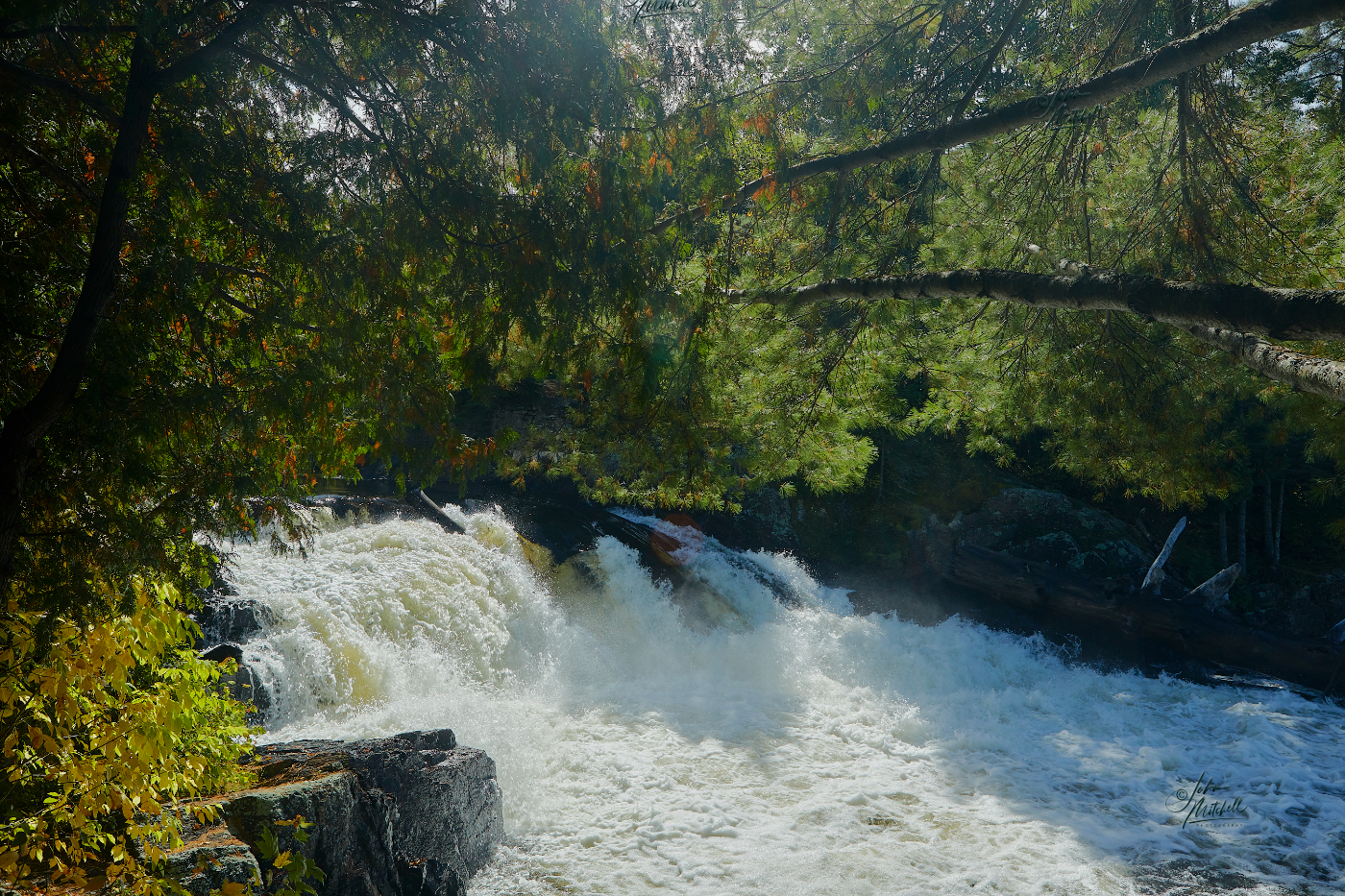
We decided to go into Huntsville and take a ride on the steam train operated by the “Huntsville and Lake of Bays Railway Society.” Upon arrival we learned the steam locamotive operated only during the summer months of July and August. With this information we decided to change our plans and go to “Ragged Falls Provincial Park” and “Oxtongue Rapids.”
At “Ragged Fallls” I parked and we walked the trail toward the falls. Larry was going to walk the trail to the top of the falls. I decided to go to the bottom of the falls. I had last been here in 2016 and ventured to the bottom of the falls and captured some great images of the rocks, water and fall colours. As I approached I could see the steep path that led to the bottom of the falls. Eight years made a big difference. I no longer felt confident in climbing down the trail to see the falls. More importantly, if I got down there could I get back up? I felt old. I hated to admit that, but there was no way I was chancing going to the bottom only to find out I needed rescuing. When Larry got back we set out for Oxtongue Rapids.
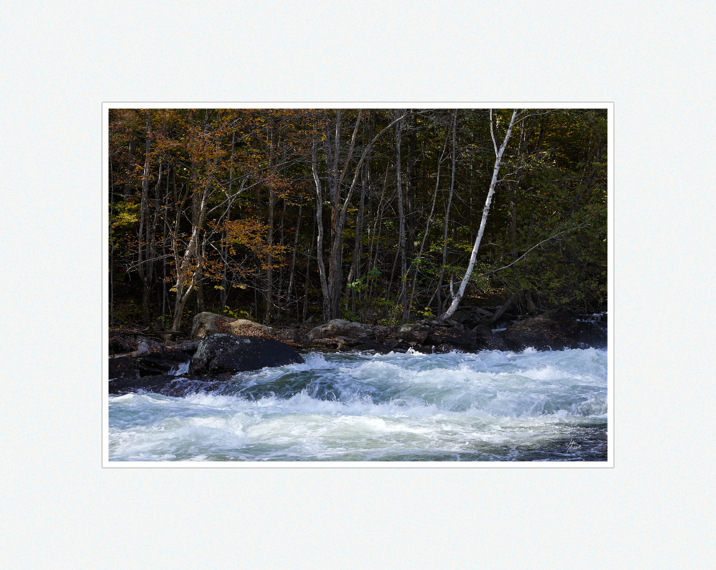
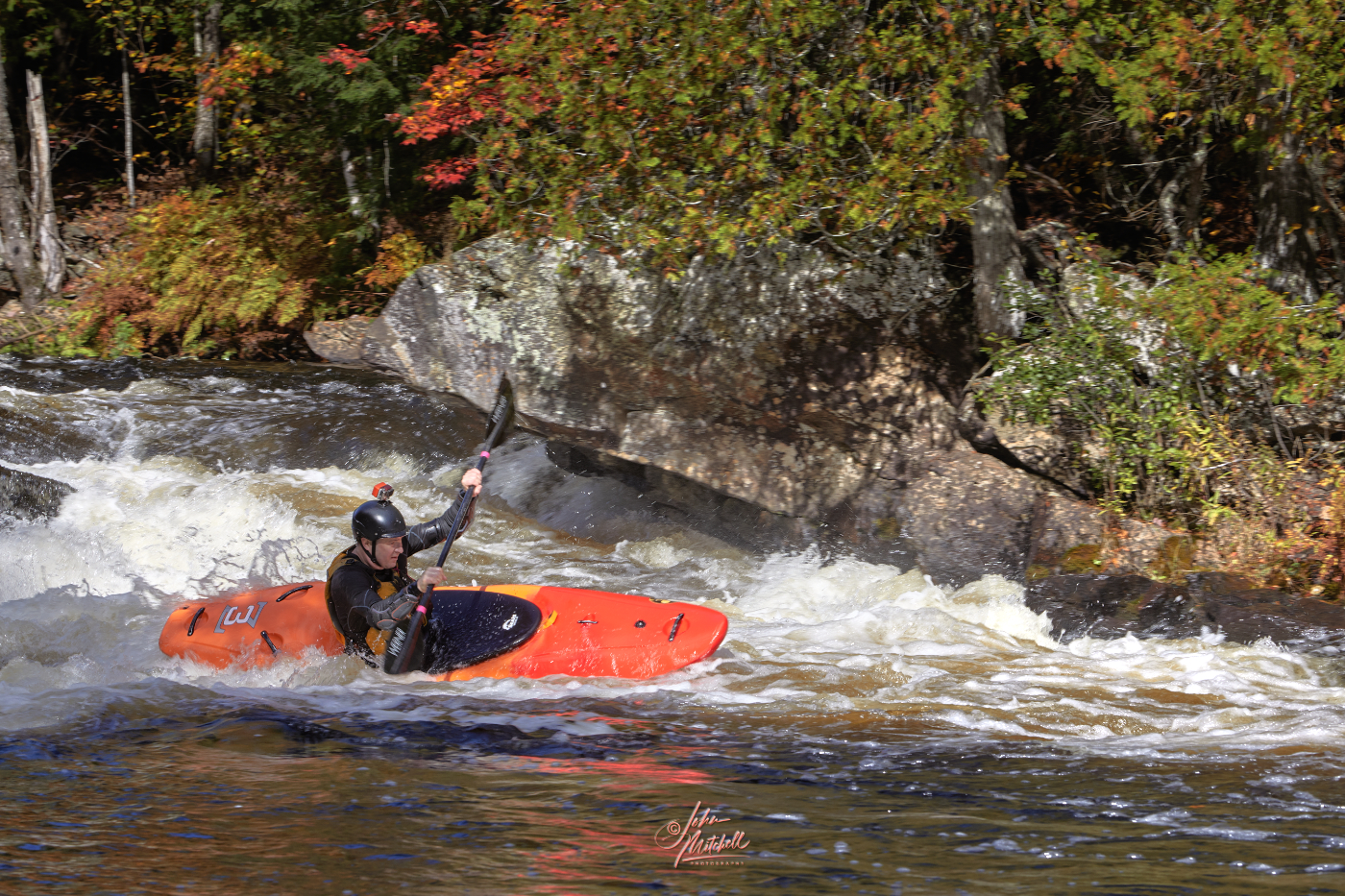
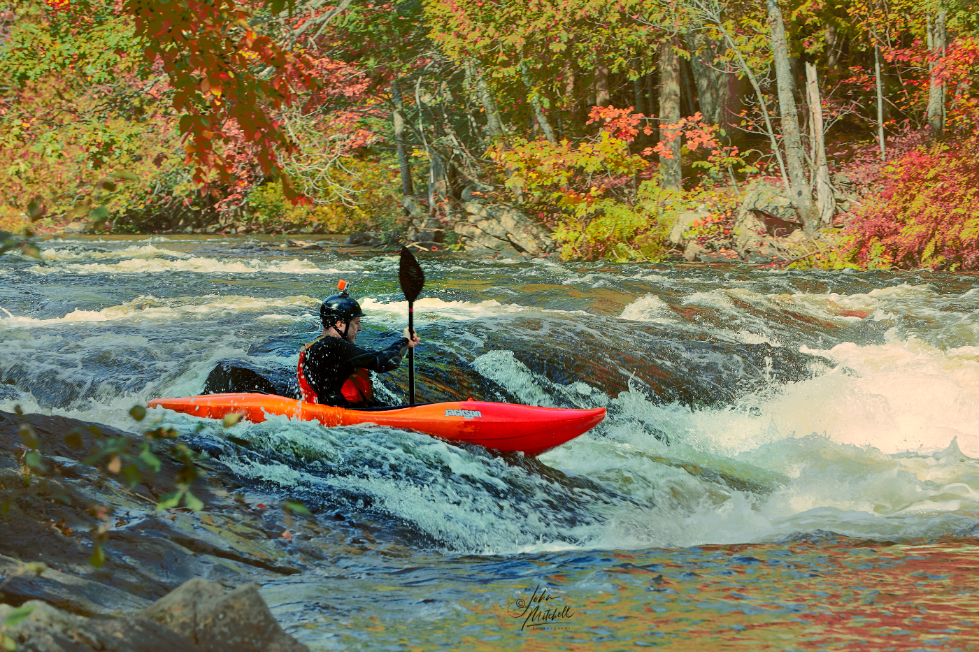
I love the scenery at Oxtongue Rapids; the rocks, the rapids, the fall colours.
Ever since I got a kayak there has been a joke about running the rapids here. Well when we got there on this fall day there was a young man walking up the path, carrying a kayak and heading to the calmer water up stream. It wasn’t long before the red kayak was visible, coming down the river. He had obviously picked his course carefully and broken it down into sections. He would shoot through one set of rapids, find calm water and stop. He seemed to look ahead and confirmed his next course before committing to it, and off he went. Sometime later he reappeared, once again carrying his kayak. I heard him tell someone “one more run.”
Day seven, October 3rd.
It’s been a great adventure but it’s time to head home. I packed my gear, thanked my brother and hit the road. I got to Webers a little after the lunch crowd rush and grabbed a burger, fry, and pop and enjoyed sitting in the sun in their park like setting. As much as I like “God’s country,” getting home also feels great. And who knows; God willing there will be more trips. There are still areas I want to explore.